Components
The following is a list of components available for OpenGeo Suite on Windows. These are accessible from the Components page of the installer.
Adding components to OpenGeo Suite can be accomplished by running the installer again and selecting the appropriate component.
Note
The list of available components differs between OpenGeo Suite and OpenGeo Suite Enterprise. For more information on OpenGeo Suite Enterprise, please contact us.
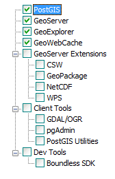
Full list of available components (OpenGeo Suite)
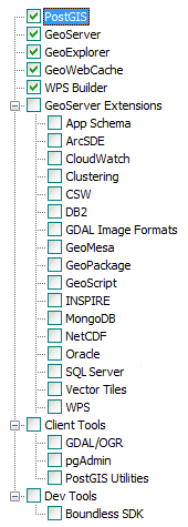
Full list of available components (OpenGeo Suite Enterprise)
Top level
| Component | Description | Availability |
|---|---|---|
| PostGIS | The PostgreSQL/PostGIS spatial database. | All versions |
| GeoServer | Server implementing OGC compliant map and feature services. | All versions |
| GeoExplorer | Map viewing and editing application. | All versions |
| GeoWebCache | Tile caching server. | All versions |
| WPS Builder | Graphical utility for executing WPS processes | OpenGeo Suite Enterprise only |
GeoServer Extensions
| Component | Description | Availability |
|---|---|---|
| App Schema | Application Schema support. | OpenGeo Suite Enterprise only |
| ArcSDE | ArcSDE database support. | OpenGeo Suite Enterprise only |
| CloudWatch | Connection to Amazon CloudWatch monitoring. | OpenGeo Suite Enterprise only |
| Clustering | Clustering plug-ins. | OpenGeo Suite Enterprise only |
| CSW | Catalogue Service for Web (CSW) support. | All versions |
| DB2 | DB2 database support. | OpenGeo Suite Enterprise only |
| GDAL Image Formats | Additional raster formats support as part of GDAL integration. | OpenGeo Suite Enterprise only |
| GeoMesa | GeoMesa data source support. | OpenGeo Suite Enterprise only |
| GeoPackage | GeoPackage data source support. | All versions |
| GeoScript | Scripting extension for GeoServer. | OpenGeo Suite Enterprise only |
| INSPIRE | Additional WMS and WFS metadata configuration for INSPIRE compliance | OpenGeo Suite Enterprise only |
| MongoDB | MongoDB database support. | OpenGeo Suite Enterprise only |
| NetCDF | NetCDF data format support (read-only) | All versions |
| Oracle | Oracle database support. | OpenGeo Suite Enterprise only |
| SQL Server | SQL Server database support. | OpenGeo Suite Enterprise only |
| Vector Tiles | Vector tile output format support. | OpenGeo Suite Enterprise only |
| WPS | Web Processing Service (WPS) support. | All versions |
Client Tools
| Component | Description | Availability |
|---|---|---|
| GDAL/OGR | Spatial data manipulation utilities such as gdal_translate and ogr2ogr. |
All versions |
| pgAdmin | Graphical PostGIS/PostgreSQL database manager. Also includes pgShapeloader a graphical utility for loading data into PostGIS | All versions |
| PostGIS Utilities | PostGIS command line data loading utilities such as psql and shp2pgsql. |
All versions |
Dev Tools
| Component | Description | Availability |
|---|---|---|
| Boundless SDK | Tool kit for building web map applications. | All versions |